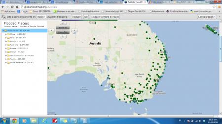
Existe un mapamundi que permite ver que ocurre si se eleva el nivel del mar, uno puede hacer el cálculo tomando como vase 6, 18 y 100 pulgadas (15.24, 45.72, 254 centímetros). De acuerdo con el IPCC podría subir por encima de 30 púlgadas (82 cm).
Con el cálculo del IPCC Australia ha comenzado a tomar algunas previsiones:

Coast protection costs rise with sea levels
Anne Davies November 03, 2013
Sydney councils and the state government are facing a multibillion-dollar bill to strengthen and maintain sea walls around the harbour and beaches in the face of rising sea levels.
But despite the threat to low-lying areas, housing densities are increasing in high-risk areas. New developments are being constructed in areas that depend on sea walls around Manly lagoon, at Rushcutters Bay, Double Bay and along the Parramatta River.
If the 82-centimetre rise in the sea level predicted by the Intergovernmental Panel on Climate Change is realised by 2100, coastal developments the length of the NSW coast will be at risk.
In Sydney, the hundreds of kilometres of walls around the harbour will become increasingly vulnerable to stronger wave action in deeper water. These waves can scour out the footings and cause ”overtopping”, when waves slop over a retaining wall and erode it from behind.
The threat comes not just from seawater advancing onto land. Sydney Coastal Councils executive director Geoff Withycombe said higher sea levels are likely to raise the water table and alter the flow of stormwater into the harbour.
This has been a concern during the approval process for the Kiaora Lands development at Double Bay.